Geocoding with QDA Miner 5.0 August 18, 2016 - Blogs on Text Analytics
So, you’ve done lots of research in either academia or business. You’ve combed through databases and found important references from many different cities, states and countries. You’ve gotten people to respond to online surveys. You’ve scoured social media and RSS feeds to find comments and trends related to your latest product launch or research project. You’re coding and analyzing direct customer feedback that you received through the customer service section of your website or in your email box.
All of this information is providing you with rich text data about your particular area of interest. All good, but do the comments or research results vary depending on where they come from? Have you considered the possibility? Could there be geographic bias based on climate, language, culture or other factors? Is the location of your data important to your project or presentation? That’s where the new geocoding feature of our qualitative analysis software QDA Miner 5 can help. QDA Miner 5’s geocoding capabilities enable you to extract and transform geographic references such as: cities, states, postal codes and IP addresses, into geographic coordinates.
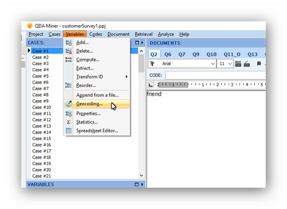
Here’s how it works. After opening your project in QDA Miner 5 go to Variables in the top tool bar and then click on Geocoding.
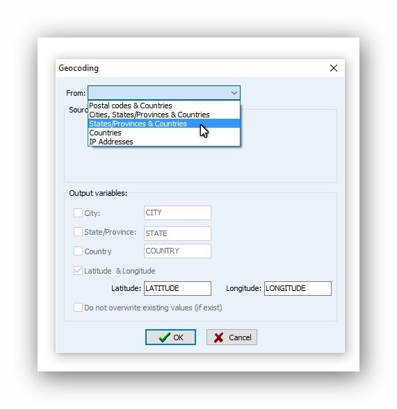
Next you will be prompted to designate a search of your case variables. In this example, we are asking the software to search through the case variables and to convert the States/Provinces & Countries locations into additional case variables, latitude and longitude. QDA Miner 5 will search through all the cases in your project and add the variables to each case.
Perhaps this result isn’t precise enough for your research or you want to dig deeper. IP addresses from electronic communication can often give you an accurate location of the city where the communication originated. If you have IP addresses as part of your case variables, select IP Addresses from the geo coding menu and then select the output variables, in this instance we selected city, state, country, latitude and longitude.
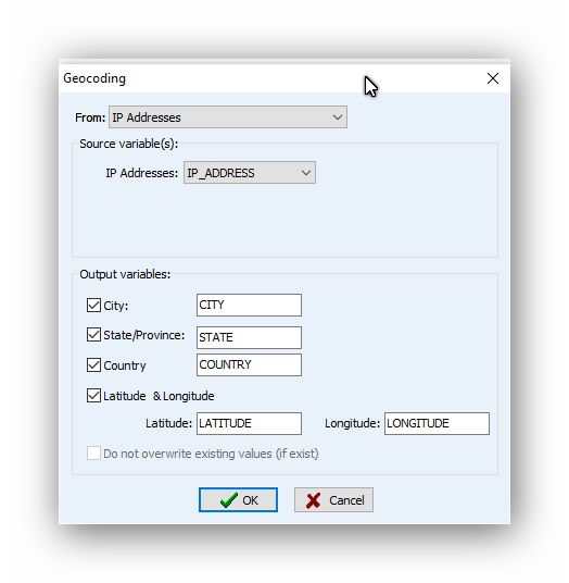
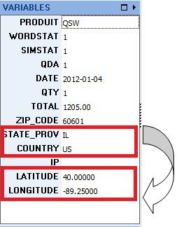
QDA Miner 5 will search the IP addresses in all your cases and update your variables. In the case example below we have excluded the IP address information because it is confidential.
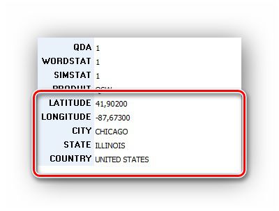
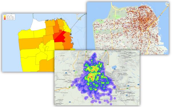
Now your case variables include a more detailed group of geographic locations. You can use this information to create maps such as: maps of interactive plot of data points, heatmaps and distribution maps. How you create these maps in QDA Miner 5 will be the subject of our upcoming blog post. Stay tuned to this space!
The new geocoding and mapping features we are including in QDA Miner 5 are also available in our text analytics tool WordStat. Click on the following link to see the GIS features of WordStat.
QDA Miner 5.0 is in beta testing. The official release is fast approaching. You can find alerts for these blog posts if you follow us on twitter, on Facebook or linkedin .
If you have other suggestions for ways we can help you with geo coding of your data please tell us by leaving a message on this blog.
Everyone who purchases QDA Miner 4 after June 1, 2016 will receive a free upgrade to QDA Miner 5.0