
The new features of WordStat text mining software
What’s New in Versions 7.1 and 7.0?
The new version 7 delivers numerous improvements allowing users to get:
• Valuable and actionable insights from text data more quickly.
• Faster and easier comparisons between unstructured and structured information.
• Greater assistance for the creation and validation of accurate text-categorization dictionaries.
• Faster analysis of larger amounts of text data.
• A GIS mapping and data editing tool to quickly relate unstructured text with geographic information and create maps.
You will find below a complete list and detailed information of the new features of WordStat 7.
Changes in Version 7.1?
The version 7.1 features a new GIS mapping and data editing module that allows one to relate unstructured text data with geographic information and create maps and other graphic displays for analysis and presentation such as:
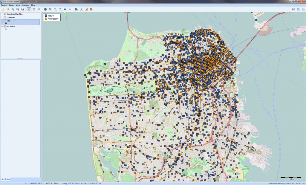
1. INTERACTIVE PLOT OF DATA POINTS
Plots of data points can be created from words, phrases, or topics extracted from unstructured text fields. One can quickly filter data points on categorical, numerical, and date variables or create dynamic range displays and custom animations to easily identify temporal trends, cyclical patterns or relationships to numerical variables. One may also customize and annotate single data points
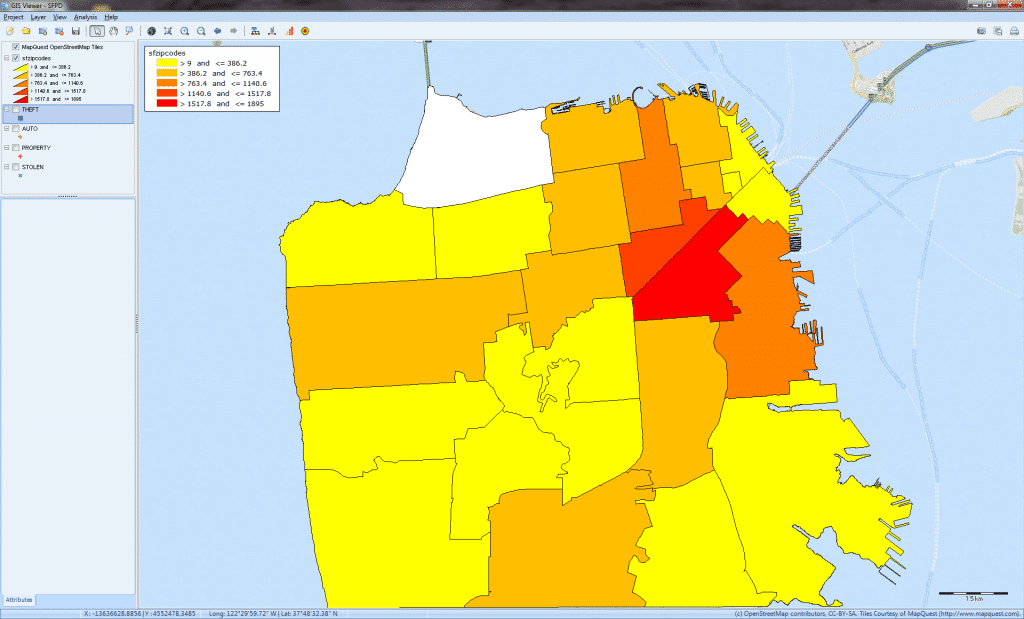
2. DISTRIBUTION MAPS
Users can create layers from various vector file formats and produce choropleth maps to represent point density, demographic information stored in shapefiles, or statistical summaries of numerical values associated with text segments. One can also easily adjust the color range, the number of steps and level of transparency.
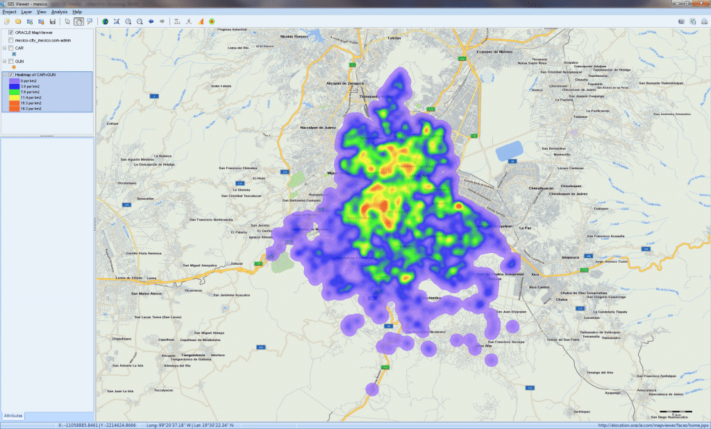
3. HEATMAPS
Density of data points can be visualized with heatmaps displays to easily identify customer concentrations, crime hot spots, or disease outbreaks. Users can also create heatmaps on all data point or just on selected regions and choose from a wide variety of color ramps or create their own.
4. GEOCODING
Integrated geocoding service is available in WordStat to tranform references to cities, states, provinces, countries, postal codes, and IP addresses into geographical coordinates.
5. OTHER GIS FEATURES
Natively opens and displays a wide range of vector, image, grid, and SQL database layer formats, including advanced spatial server geodatabases. WMS, WFS, and WMTS mapping services.
Comprehensive visual layer property, legend, and scale controls provide for deep customization of the map appearance.
Create, edit, translate, and export map layers in a number of vector, image, grid, and database formats.
Support for coordinate systems with on-the-fly layer reprojection between thousands of predefined geographic and projected coordinate systems or any coordinate system defined from 150+ projections and 900+ datums.
Saving of maps to industry standard graphic file formats (BMP, PNG, JPG) and georeferenced world files as well as AVI movie files.
Changes in Version 7.0?
1. TOPIC EXTRACTION TOOL
A new topic modelling tool based on factor analysis has been implemented to quickly extract topics from large collections of documents. Obtained topics may be renamed, merged, or deleted. A side panel also allows one to compare the frequency of specific topics across other variables using bar charts or line charts.